Valley Brook Inn & Cottages

Valley Brook Inn & Cottages

Valley Brook Inn & Cottages (Wurtsboro,США)

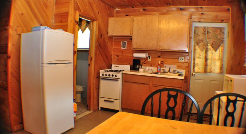
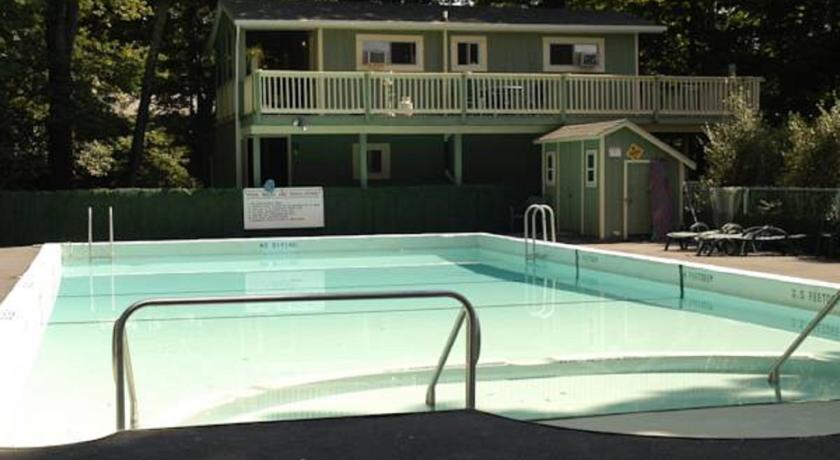
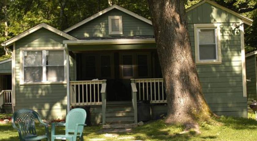
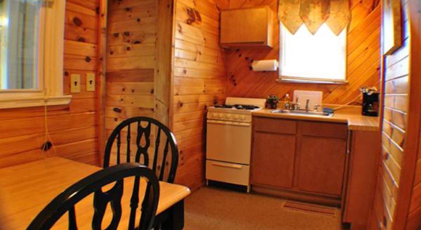
Категория отеля:
Адрес: 201 Kingston Avenue, Wurtsboro, NY 12790, США
Описание: В этом комплексе для отдыха в городке Уэртсборо есть открытый бассейн и организуются многочисленные мероприятия для гостей на территории. Здесь к услугам гостей волейбольные и баскетбольные площадки и площадка для игры в подковы. Предоставляется бесплатный WiFi.В каждом коттедже в комплексе для отдыха Valley Brook Inn & Cottages есть полноценная кухня. В номерах с видом на сад также имеется гостиный уголок, телевизор и кондиционер. В ванной комнате предоставляются бесплатные туалетно-косметические принадлежности.В распоряжении гостей комплекса для отдыха Valley Brook Inn & Cottages детская игровая площадка. Гости также могут отдохнуть в саду или в большой беседке или согреться рядом с одним из костров.Центр искусств Вефиль Вудс находится всего в 30 минутах езды. Аэропорт Уертсборо расположен в 3,3 км.
Еда и питье:
На свежем воздухе: Открытый бассейн (работает по сезонам), Сад
Парковка: Частная парковка на месте (предварительный заказ не требуется) предоставляется за дополнительную плату.
Услуги: Номера для некурящих, Отопление, Кондиционер
Спорт и отдых: Детская игровая площадка
Сервис: Конференц-зал/Банкетный зал
Интернет: Бесплатно! Wi-Fi предоставляется на территории всего отеля бесплатно.
Языки общения:
Время заезда/выезда: 15:00 - 22:00 / До 11:00
Домашние животные: Бесплатно! Размещение домашних животных допускается по предварительному запросу. Дополнительная плата не взимается.
Банковские карты:
Номерной фонд: Номеров в отеле: 2
Координаты: ш. 41.5781911 д. -74.48722149999998 на карте
 

Каталог отелей.

Игры ⚽ Нужен реферат?

Полезное


Смотреть что такое "Valley Brook Inn & Cottages" в других словарях:

  • Neighborhoods of Oklahoma City — This article is about the neighborhoods in Oklahoma City. For more general information, see Oklahoma City. The City of Oklahoma City uses Special Zoning Districts as a tool to maintain the character of many neighborhood communities. Contents 1… …   Wikipedia

  • Lydbrook — infobox UK place official name= Lydbrook latitude= 51.84 longitude= 2.58 shire district= Forest of Dean shire county = Gloucestershire region= South West England country= England constituency westminster= Forest of Dean post town= LYDBROOK… …   Wikipedia

  • Allegany State Park — Infobox park park=Allegany State Park image size=275px caption=The park administration building from across Red House Lake. type=State park location=Cattaraugus County, New York coordinates=coord|42.115| 78.72|display=inline,title size acre=65000 …   Wikipedia

  • Northfield, Birmingham — Coordinates: 52°24′29″N 1°57′47″W / 52.408°N 1.963°W / 52.408; 1.963 …   Wikipedia

  • Civil parishes in Lancashire — A map of Lancashire, showing the Boroughs : (1) West Lancashire; (2) Chorley; (3) South Ribble; (4) Fylde; (5) Preston; (6) Wyre; (7) Lancaster; (8) Ribble Valley; (9) Pendle; (10) Burnley; (11) Rossendale; (12) Hyndburn; (13) Blackpool; and …   Wikipedia

  • Walmley — Infobox UK place country = England official name= Walmley latitude= 52.540464 longitude= 1.800289 map type= West Midlands population = population density = metropolitan borough= Birmingham metropolitan county= West Midlands region= West Midlands… …   Wikipedia

  • Redhill, Somerset — infobox UK place country = England latitude= 51.366979 longitude= 2.725859 official name= Redhill civil parish= population = unitary england= North Somerset lieutenancy england=Somerset region= South West England constituency westminster=… …   Wikipedia

  • Civil parishes in Cheshire — A map of Cheshire, showing the Boroughs : (1) Cheshire West and Chester; (2) Cheshire East; (3) Warrington; and (4) Halton. A civil parish is a subnational entity, forming the lowest unit of local government in England. There are 332 civil… …   Wikipedia

  • National Register of Historic Places listings in Buncombe County, North Carolina — Map of all coordinates from Google Map of all coordinates from Bing …   Wikipedia

  • Milnrow — Coordinates: 53°36′36″N 2°06′40″W / 53.6101°N 2.1111°W / 53.6101; 2.1111 …   Wikipedia


Поделиться ссылкой на выделенное

Прямая ссылка:
Нажмите правой клавишей мыши и выберите «Копировать ссылку»